Petrel exploration geology
Analyze petroleum systems from basin to prospect scale.

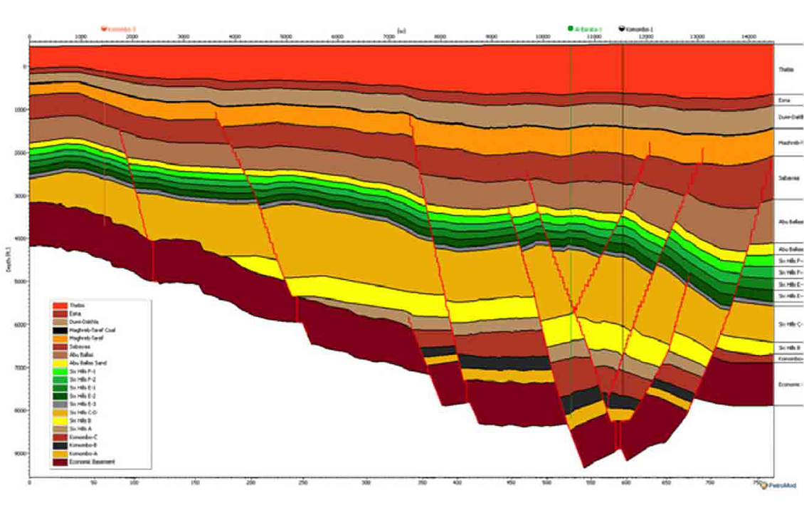
Petroleum systems models are 1D, 2D, or 3D large-scale geologic models. These models cover areas ranging from a single charge area for a prospect to regional studies of entire basins and resource assessments at a megaregional scale covering multiple basins. The models provide a complete record of the evolution of a petroleum system, including pressure and temperature history. A petroleum systems model provides the only means to integrate all physical aspects (source, trap, seal, and reservoir) and time (charge) to quantify and analyze processes and reduce exploration risk. Models can be built in the Petrel E&P software platform, which provides full integration with critical input data such as seismic and well data, the structural framework, and Petromod software’s stand-alone builders. Models could also be built in Petromod software directly.
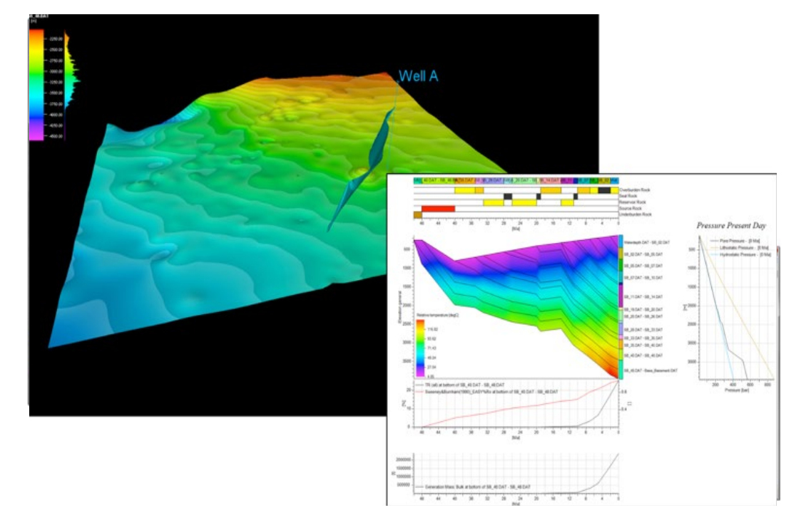
Petromod petroleum systems modeling software combines seismic, well, and geological interpretation to model the evolution of a sedimentary basin. Simulations in Petromod software help to predict pressures and temperatures, as well as assess if, and how, a reservoir has been charged with hydrocarbons.
The simulations also predict the timing of hydrocarbon generation, migration routes, quantities, and hydrocarbon type in the subsurface and at surface conditions. Petromod software provides a standardized user interface across the entire 1D, 2D, and 3D modeling workflows. The same simulator is used with all technical features and tools available and identical in all dimensions, ensuring full compatibility.

Petromod software’s petroleum systems model-building capabilities training courses address the unique need of each learner, our courses, delivered by world-class experts, teach learners how to deal with real-life scenarios and solve genuine problems.
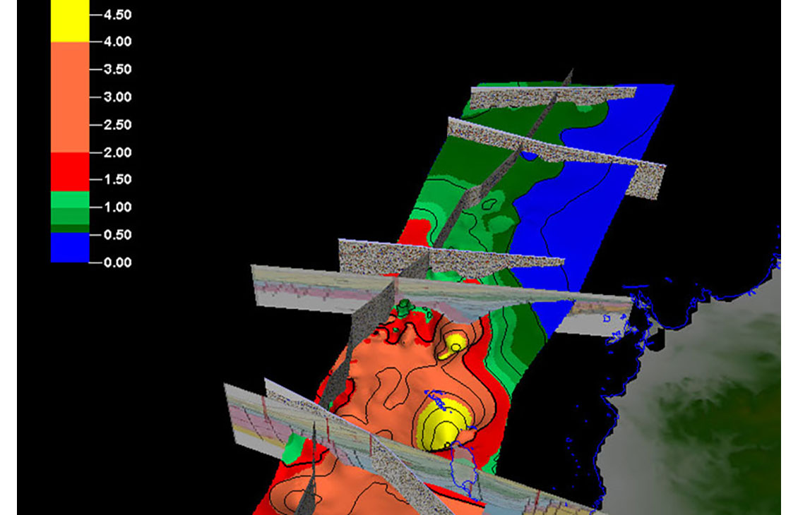
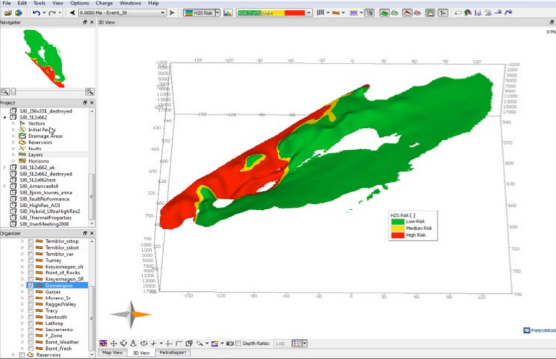
Analyze simulation results and hydrocarbon accumulations through geological time.
Analyze simulation results and hydrocarbon accumulations through geological time.
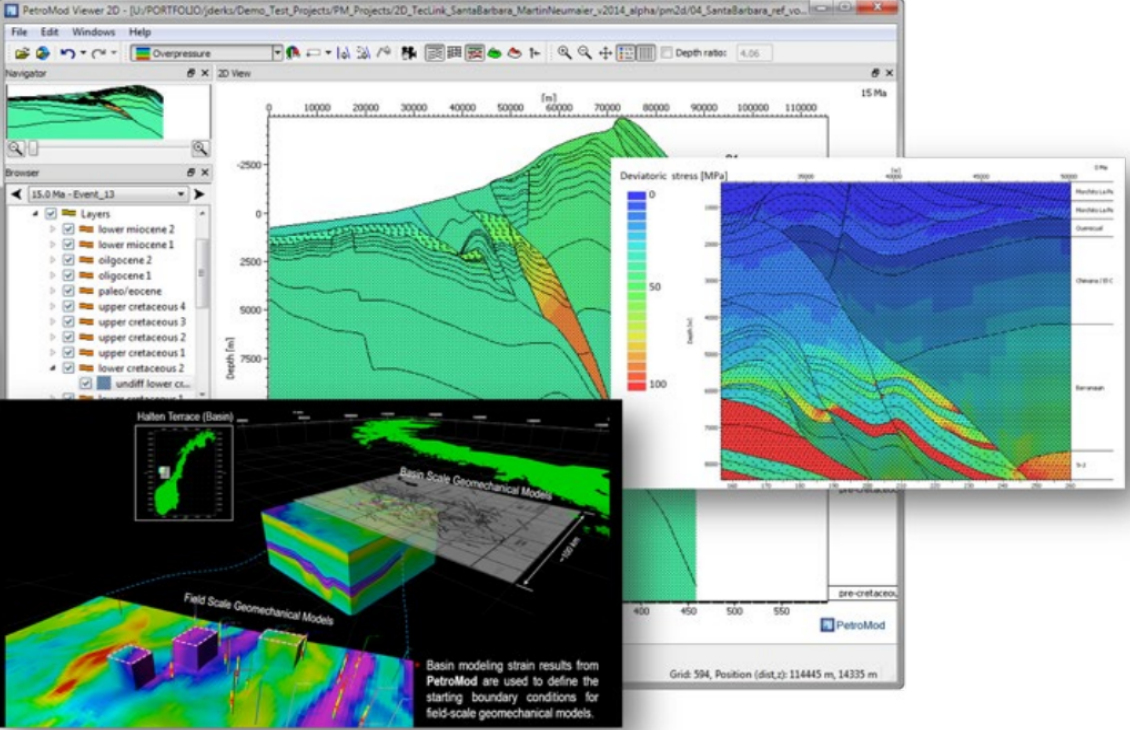
Basin-scale geomechanics and pore pressure prediction.
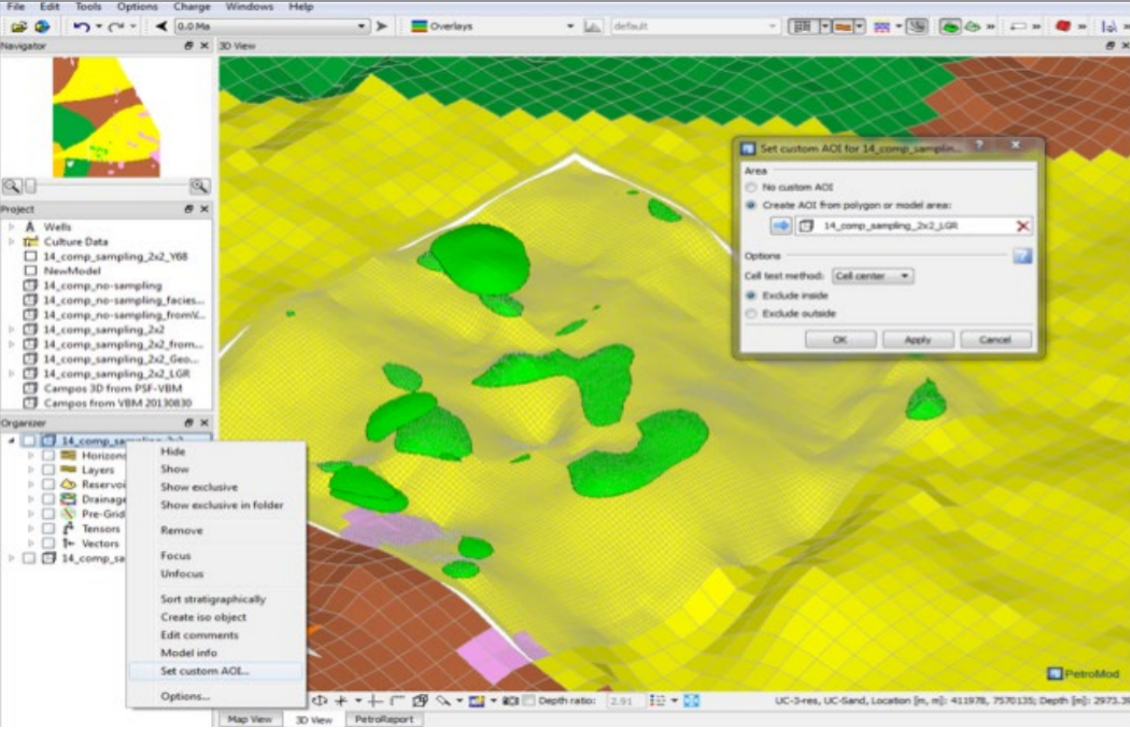
Evaluate the impact of uncertainties with Petrorisk or calibrate models with the heatflow calibration tool.
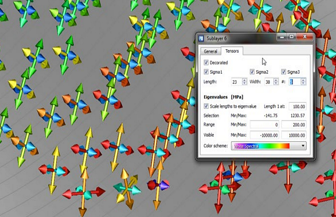
Calculate user-defined output functions beyond the default simulator output.
1D, 2D, and 3D models capturing geological processes through time.
Capabilities of the engine for Petromod software.